| Magnitude | 2.9 |
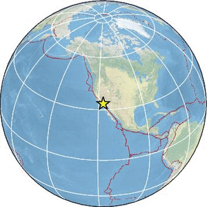
| Region | SOUTHERN CALIFORNIA |
| Date time | 2026-07-31 20:10:14.6 UTC |
| Location | 33.354 ; -116.952 |
| Depth | 18 km |
| Distance | 24 km ESE of Temecula, United States / pop: 110,000 / local time: 13:10:14.6 2026-07-31 17 km NNE of Valley Center, United States / pop: 9,200 / local time: 13:10:14.6 2026-07-31 |
Source parameters provided by:
National Earthquake Information Center, U.S. Geological Survey -- Golden, United States (NEIC)
All data providers for this event:
Southern California Seismic Network, California Institute of Technology / USGS - Pasadena -- Pasadena, United States (SCSN)National Earthquake Information Center, U.S. Geological Survey -- Golden, United States (NEIC)
Further information can be found at:
GeoForschungsZentrum (GFZ) -- Potsdam, Germany (GFZ)National Earthquake Information Center, U.S. Geological Survey -- Golden, United States (NEIC)