| Magnitude | 5.7 |
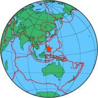
| Region | SAMAR, PHILIPPINES |
| Date time | 2012-01-17 12:55:36.4 UTC |
| Location | 11.192 ; 125.917 |
| Depth | 31 km |
| Distance | 100 km E of Panalanoy, Philippines / pop: 189,000 / local time: 20:55:36.4 2012-01-17 28 km NE of Guiuan, Philippines / pop: 11,000 / local time: 20:55:36.4 2012-01-17 |
All data providers for this event:
National Institute for Earth Physics -- Bucharest, Romania (NIEP)GeoForschungsZentrum (GFZ) -- Potsdam, Germany (GFZ)
The research institute NORSAR -- Kjeller, Norway (NORSAR)
Republican Seismic Survey Center or Azerbaijan National Academy of Sciences -- Baku, Azerbaijan (RSSC)
Geophysical Survey of the Russian Academy of Sciences -- Obninsk, Russia (GSRAS)
Bundesanstalt fur Geowissenschaften und Rohstoffe, German Regional Seismograph Network -- Hannover, Germany (BGR)
National Earthquake Information Center, U.S. Geological Survey -- Golden, United States (NEIC)
GeoSphere Austria -- Vienna, Austria (GSA)
Further information can be found at:
Philippine Inst. of Volcanology and Seismology, Quezon City, Philippines -- Manila, Philippines (PIVS)National Earthquake Information Center, U.S. Geological Survey -- Golden, United States (NEIC)
GeoForschungsZentrum (GFZ) -- Potsdam, Germany (GFZ)