| Magnitude | 2.6 |
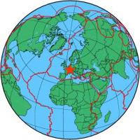
| Region | FRANCE-GERMANY BORDER REGION |
| Date time | 2012-01-28 05:31:41.4 UTC |
| Location | 47.943 ; 7.163 |
| Depth | 5 km |
| Distance | 25 km NW of Mulhouse, France / pop: 111,000 / local time: 06:31:41.4 2012-01-28 4 km NW of Guebwiller, France / pop: 12,500 / local time: 06:31:41.4 2012-01-28 |
All data providers for this event:
Landsamt fur Geologie, Rohstoffe und Bergbau -- Freiburg, Germany (LED)Swiss Seismological Service -- Zurich, Switzerland (ETHZ)
Laboratoire de Detection et de Geophysique -- Bruyeres-le-Chatel, France (LDG)
Bundesanstalt fur Geowissenschaften und Rohstoffe, German Regional Seismograph Network -- Hannover, Germany (BGR)
Further information can be found at:
Laboratoire de Detection et de Geophysique -- Bruyeres-le-Chatel, France (LDG)