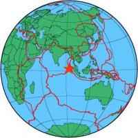
| Magnitude | 5.3 |
| Region | OFF W COAST OF NORTHERN SUMATRA |
| Date time | 2012-04-12 13:09:49.0 UTC |
| Location | 2.439 ; 93.372 |
| Depth | 30 km |
| Distance | 408 km SSW of Banda Aceh, Indonesia / pop: 250,000 / local time: 20:09:49.0 2012-04-12 334 km WSW of Sinabang, Indonesia / pop: 15,000 / local time: 20:09:49.0 2012-04-12 |
All data providers for this event:
The research institute NORSAR -- Kjeller, Norway (NORSAR)Geophysical Survey of the Russian Academy of Sciences -- Obninsk, Russia (GSRAS)
Bundesanstalt fur Geowissenschaften und Rohstoffe, German Regional Seismograph Network -- Hannover, Germany (BGR)
National Earthquake Information Center, U.S. Geological Survey -- Golden, United States (NEIC)
Further information can be found at:
Badan Meteorologi, Klimatologi dan Geofisika -- Jakarta, Indonesia (BMKG)GeoForschungsZentrum (GFZ) -- Potsdam, Germany (GFZ)
National Earthquake Information Center, U.S. Geological Survey -- Golden, United States (NEIC)