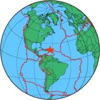
| Magnitude | 4.4 |
| Region | VIRGIN ISLANDS REGION |
| Date time | 2012-08-29 21:07:18.0 UTC |
| Location | 19.670 ; -64.271 |
| Depth | 17 km |
| Distance | 163 km NNE of Charlotte Amalie, U.S. Virgin Islands / pop: 20,000 / local time: 17:07:18.0 2012-08-29 143 km N of Road Town, British Virgin Islands / pop: 8,400 / local time: 17:07:18.0 2012-08-29 |
All data providers for this event:
National Earthquake Information Center, U.S. Geological Survey -- Golden, United States (NEIC)Further information can be found at:
GeoForschungsZentrum (GFZ) -- Potsdam, Germany (GFZ)National Earthquake Information Center, U.S. Geological Survey -- Golden, United States (NEIC)