| Magnitude | 4.6 |
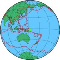
| Region | NEW IRELAND REGION, P.N.G. |
| Date time | 2012-11-02 11:38:57.1 UTC |
| Location | -4.300 ; 153.671 |
| Depth | 108 km |
| Distance | 898 km WNW of Honiara, Solomon Islands / pop: 56,200 / local time: 22:38:57.1 2012-11-02 156 km ENE of Kokopo, Papua New Guinea / pop: 26,200 / local time: 21:38:57.1 2012-11-02 |
All data providers for this event:
GeoForschungsZentrum (GFZ) -- Potsdam, Germany (GFZ)National Earthquake Information Center, U.S. Geological Survey -- Golden, United States (NEIC)
Further information can be found at:
National Earthquake Information Center, U.S. Geological Survey -- Golden, United States (NEIC)Badan Meteorologi, Klimatologi dan Geofisika -- Jakarta, Indonesia (BMKG)
GeoForschungsZentrum (GFZ) -- Potsdam, Germany (GFZ)