| Magnitude | 4.1 |
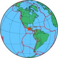
| Region | OFF COAST OF CHIAPAS, MEXICO |
| Date time | 2013-10-27 13:44:51.5 UTC |
| Location | 14.303 ; -93.378 |
| Depth | 40 km |
| Distance | 138 km SW of Tapachula, Mexico / pop: 202,000 / local time: 07:44:51.5 2013-10-27 113 km SW of Puerto Madero, Mexico / pop: 9,500 / local time: 07:44:51.5 2013-10-27 |
All data providers for this event:
National Earthquake Information Center, U.S. Geological Survey -- Golden, United States (NEIC)Further information can be found at:
Servicio Sismologico Nacional, Instituto de Geofisica, UNAM -- Mexico City, Mexico (UNM)GeoForschungsZentrum (GFZ) -- Potsdam, Germany (GFZ)
National Earthquake Information Center, U.S. Geological Survey -- Golden, United States (NEIC)