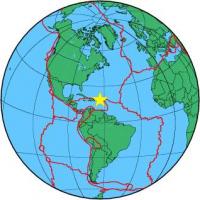
| Magnitude | 4.0 |
| Region | VIRGIN ISLANDS REGION |
| Date time | 2014-04-15 05:50:27.8 UTC |
| Location | 18.976 ; -63.764 |
| Depth | 43 km |
| Distance | 124 km NW of Marigot, Saint Martin / pop: 5,700 / local time: 01:50:27.8 2014-04-15 109 km NE of Road Town, British Virgin Islands / pop: 8,400 / local time: 01:50:27.8 2014-04-15 |
All data providers for this event:
Alaska Tsunami Warning Seismic System, West Coast and Alaska Tsunami Warning Center -- Anchorage, United States (AT)Puerto Rico Seismic Network (PRSN) and Puerto Rico Strong Motion Program (PRSMP), University of Puerto Rico at Mayaguez -- Mayagueez, Puerto Rico (PR)
Further information can be found at:
GeoForschungsZentrum (GFZ) -- Potsdam, Germany (GFZ)University of the West Indies, St. Augustine, Trinidad -- Saint Augustine, Trinidad and Tobago (TRN)
National Earthquake Information Center, U.S. Geological Survey -- Golden, United States (NEIC)