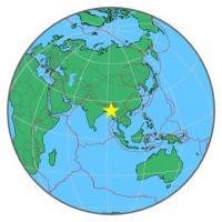
| Magnitude | 4.8 |
| Region | MYANMAR-INDIA BORDER REGION |
| Date time | 2014-06-04 07:20:14.0 UTC |
| Location | 22.531 ; 93.415 |
| Depth | 53 km |
| Distance | 151 km SE of Aizawl, India / pop: 265,000 / local time: 12:50:14.0 2014-06-04 24 km SW of Hakha, Myanmar / pop: 20,000 / local time: 13:50:14.0 2014-06-04 |
All data providers for this event:
National Institute for Earth Physics -- Bucharest, Romania (NIEP)GeoForschungsZentrum (GFZ) -- Potsdam, Germany (GFZ)
The research institute NORSAR -- Kjeller, Norway (NORSAR)
Geophysical Survey of the Russian Academy of Sciences -- Obninsk, Russia (GSRAS)
National Earthquake Information Center, U.S. Geological Survey -- Golden, United States (NEIC)
Further information can be found at:
India Meteorological Department, New Delhi, India -- New Delhi, India (NDI)National Earthquake Information Center, U.S. Geological Survey -- Golden, United States (NEIC)
GeoForschungsZentrum (GFZ) -- Potsdam, Germany (GFZ)