| Magnitude | 6.7 |
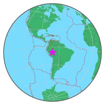
| Region | PERU-BRAZIL BORDER REGION |
| Date time | 2015-11-26 05:45:18.2 UTC |
| Location | -9.211 ; -71.256 |
| Depth | 609 km |
| Distance | 374 km E of Pucallpa, Peru / pop: 310,000 / local time: 00:45:18.2 2015-11-26 129 km SSW of Tarauacá, Brazil / pop: 16,500 / local time: 00:45:18.2 2015-11-26 |
All data providers for this event:
Geoscience Australia, Canberra, ACT, Australia -- Canberra, Australia (AUST)GeoForschungsZentrum (GFZ) -- Potsdam, Germany (GFZ)
Republican Seismic Survey Center or Azerbaijan National Academy of Sciences -- Baku, Azerbaijan (RSSC)
Geophysical Survey of the Russian Academy of Sciences -- Obninsk, Russia (GSRAS)
Kandilli Observatory and Earthquake Research Institute -- Istanbul, Türkiye (KOERI)
Instituto Nazionale di Geofisica e Vulcanologia -- Rome, Italy (INGV) -- DOI: https://terremoti.ingv.it/en/iside
India Meteorological Department, New Delhi, India -- New Delhi, India (NDI)
National Earthquake Information Center, U.S. Geological Survey -- Golden, United States (NEIC)
Further information can be found at:
National Earthquake Information Center, U.S. Geological Survey -- Golden, United States (NEIC)Escuela Politecnica Nacional, Quito, Ecuador -- Quito, Ecuador (QUI)
Centro de Sismologia da Universidade de Sao Paulo (member of the RSBR) -- Sao Paulo, Brazil (USP)
GeoForschungsZentrum (GFZ) -- Potsdam, Germany (GFZ)
Instituto Geofisico del Peru -- Lima, Peru (LIM)