| Magnitude | 4.8 |
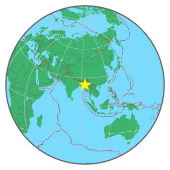
| Region | MYANMAR-INDIA BORDER REGION |
| Date time | 2016-05-19 23:10:25.4 UTC |
| Location | 22.799 ; 93.994 |
| Depth | 52 km |
| Distance | 140 km WNW of Monywa, Myanmar / pop: 182,000 / local time: 05:40:25.4 2016-05-20 43 km NE of Hakha, Myanmar / pop: 20,000 / local time: 05:40:25.4 2016-05-20 |
All data providers for this event:
National Institute for Earth Physics -- Bucharest, Romania (NIEP)GeoForschungsZentrum (GFZ) -- Potsdam, Germany (GFZ)
HUN-REN EPSS Kövesligethy Radó Seismological Observato -- Budapest, Hungary (BUD)
Republican Seismic Survey Center or Azerbaijan National Academy of Sciences -- Baku, Azerbaijan (RSSC)
Geophysical Survey of the Russian Academy of Sciences -- Obninsk, Russia (GSRAS)
Kandilli Observatory and Earthquake Research Institute -- Istanbul, Türkiye (KOERI)
National Earthquake Information Center, U.S. Geological Survey -- Golden, United States (NEIC)
Further information can be found at:
GeoForschungsZentrum (GFZ) -- Potsdam, Germany (GFZ)National Earthquake Information Center, U.S. Geological Survey -- Golden, United States (NEIC)
India Meteorological Department, New Delhi, India -- New Delhi, India (NDI)