| Magnitude | 4.9 |
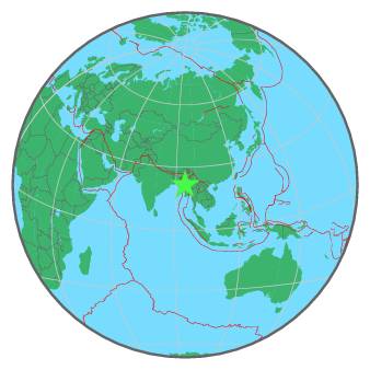
| Region | MYANMAR |
| Date time | 2016-07-27 04:20:28.2 UTC |
| Location | 21.604 ; 94.658 |
| Depth | 97 km |
| Distance | 75 km SSW of Monywa, Myanmar / pop: 182,000 / local time: 10:50:28.2 2016-07-27 53 km WNW of Pakokku, Myanmar / pop: 126,000 / local time: 10:50:28.2 2016-07-27 |
All data providers for this event:
National Institute for Earth Physics -- Bucharest, Romania (NIEP)Laboratoire de Detection et de Geophysique -- Bruyeres-le-Chatel, France (LDG)
GeoForschungsZentrum (GFZ) -- Potsdam, Germany (GFZ)
Republican Seismic Survey Center or Azerbaijan National Academy of Sciences -- Baku, Azerbaijan (RSSC)
Geophysical Survey of the Russian Academy of Sciences -- Obninsk, Russia (GSRAS)
Kandilli Observatory and Earthquake Research Institute -- Istanbul, Turkey (KOERI)
National Earthquake Information Center, U.S. Geological Survey -- Golden, United States (NEIC)
Further information can be found at:
GeoForschungsZentrum (GFZ) -- Potsdam, Germany (GFZ)National Earthquake Information Center, U.S. Geological Survey -- Golden, United States (NEIC)