| Magnitude | 4.1 |
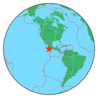
| Region | OFF COAST OF MICHOACAN, MEXICO |
| Date time | 2017-04-02 10:48:22.0 UTC |
| Location | 16.110 ; -104.070 |
| Depth | 5 km |
| Distance | 336 km SSE of Manzanillo, Mexico / pop: 130,000 / local time: 05:48:22.0 2017-04-02 283 km SSW of La Mira, Mexico / pop: 13,400 / local time: 05:48:22.0 2017-04-02 |
All data providers for this event:
Servicio Sismologico Nacional, Instituto de Geofisica, UNAM -- Mexico City, Mexico (UNM)National Earthquake Information Center, U.S. Geological Survey -- Golden, United States (NEIC)
Further information can be found at:
GeoForschungsZentrum (GFZ) -- Potsdam, Germany (GFZ)Servicio Sismologico Nacional, Instituto de Geofisica, UNAM -- Mexico City, Mexico (UNM)
National Earthquake Information Center, U.S. Geological Survey -- Golden, United States (NEIC)