| Magnitude | 3.4 |
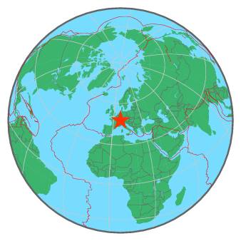
| Region | FRANCE-GERMANY BORDER REGION |
| Date time | 2018-05-04 21:36:41.4 UTC |
| Location | 47.760 ; 7.540 |
| Depth | 20 km |
| Distance | 16 km ENE of Mulhouse, France / pop: 111,000 / local time: 23:36:41.4 2018-05-04 9 km SW of Müllheim, Germany / pop: 18,000 / local time: 23:36:41.4 2018-05-04 |
All data providers for this event:
Swiss Seismological Service -- Zurich, Switzerland (ETHZ)Landsamt fur Geologie, Rohstoffe und Bergbau -- Freiburg, Germany (LED)
Laboratoire de Detection et de Geophysique -- Bruyeres-le-Chatel, France (LDG)
Bundesanstalt fur Geowissenschaften und Rohstoffe, German Regional Seismograph Network -- Hannover, Germany (BGR)
Instituto Nazionale di Geofisica e Vulcanologia -- Rome, Italy (INGV) -- DOI: https://terremoti.ingv.it/en/iside
National Earthquake Information Center, U.S. Geological Survey -- Golden, United States (NEIC)
Geoazur (Universite Cote d'Azur, IRD, CNRS, Observatoire de la Cote d'Azur) -- Nice, France (OCA)
Further information can be found at:
Landsamt fur Geologie, Rohstoffe und Bergbau -- Freiburg, Germany (LED)Bundesanstalt fur Geowissenschaften und Rohstoffe, German Regional Seismograph Network -- Hannover, Germany (BGR)
Laboratoire de Detection et de Geophysique -- Bruyeres-le-Chatel, France (LDG)