| Magnitude | 4.9 |
| Region | VIRGIN ISLANDS REGION |
| Date time | 2018-11-14 00:10:33.9 UTC |
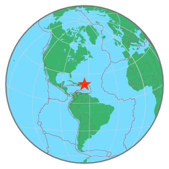
| Location | 19.604 ; -65.107 |
| Depth | 38 km |
| Distance | 141 km NNW of Road Town, British Virgin Islands / pop: 8,400 / local time: 20:10:33.9 2018-11-13 142 km NNW of Charlotte Amalie, U.S. Virgin Islands / pop: 20,000 / local time: 20:10:33.9 2018-11-13 |
All data providers for this event:
Red Sismica Nacional de Colombia, INGEOMINAS, Bogota, Colombia -- Bogota, Colombia (RSNC)Pacific Tsunami Warning Seismic System, Pacific Tsunami Warning Center, Ewa Beach, Hawaii -- Ewa Beach, United States (PT)
Puerto Rico Seismic Network (PRSN) and Puerto Rico Strong Motion Program (PRSMP), University of Puerto Rico at Mayaguez -- Mayagueez, Puerto Rico (PR)
National Earthquake Information Center, U.S. Geological Survey -- Golden, United States (NEIC)
Further information can be found at:
GeoForschungsZentrum (GFZ) -- Potsdam, Germany (GFZ)National Earthquake Information Center, U.S. Geological Survey -- Golden, United States (NEIC)