| Magnitude | 4.8 |
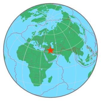
| Region | IRAN-IRAQ BORDER REGION |
| Date time | 2020-03-13 07:02:05.8 UTC |
| Location | 32.716 ; 47.485 |
| Depth | 10 km |
| Distance | 92 km S of Kūhdasht, Iran / pop: 100,000 / local time: 10:32:05.8 2020-03-13 20 km ENE of Dehlorān, Iran / pop: 46,000 / local time: 10:32:05.8 2020-03-13 |
All data providers for this event:
Institute of Geophysics, University of Tehran -- Tehran, Iran (IGUT)National Institute for Earth Physics -- Bucharest, Romania (NIEP)
Seismological Survey of Serbia -- Belgrade, Serbia (BEO)
GeoForschungsZentrum (GFZ) -- Potsdam, Germany (GFZ)
HUN-REN EPSS Kövesligethy Radó Seismological Observato -- Budapest, Hungary (BUD)
Republican Seismic Survey Center or Azerbaijan National Academy of Sciences -- Baku, Azerbaijan (RSSC)
International Institute for Earthquake Engineering and Seismology -- Tehran, Iran (IIEES)
Badan Meteorologi, Klimatologi dan Geofisika -- Jakarta, Indonesia (BMKG)
Geophysical Survey of the Russian Academy of Sciences -- Obninsk, Russia (GSRAS)
National Earthquake Information Center, U.S. Geological Survey -- Golden, United States (NEIC)
Further information can be found at:
International Institute for Earthquake Engineering and Seismology -- Tehran, Iran (IIEES)Institute of Geophysics, University of Tehran -- Tehran, Iran (IGUT)
Geophysical Survey of the Russian Academy of Sciences -- Obninsk, Russia (GSRAS)