| Magnitude | 5.1 |
| Region | KEPULAUAN BARAT DAYA, INDONESIA |
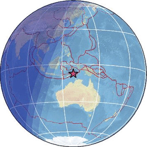
| Date time | 2026-01-12 21:59:32.3 UTC |
| Location | -7.585 ; 128.884 |
| Depth | 94 km |
| Distance | 380 km ENE of Dili, Timor Leste / pop: 150,000 / local time: 06:59:32.3 2026-01-13 232 km NE of Lospalos, Timor Leste / pop: 17,100 / local time: 06:59:32.3 2026-01-13 |
Source parameters reviewed by a seismologist
All data providers for this event:
Geoscience Australia, Canberra, ACT, Australia -- Canberra, Australia (AUST)Badan Meteorologi, Klimatologi dan Geofisika -- Jakarta, Indonesia (BMKG)
GeoForschungsZentrum (GFZ) -- Potsdam, Germany (GFZ)
Geophysical Survey of the Russian Academy of Sciences -- Obninsk, Russia (GSRAS)
Ukrainian NDC, Main Center of Special Monitoring -- Kyiv, Ukraine (MCSM)
Malaysian Meteorological Department -- Kuala Lumpur, Malaysia (MET)
National Earthquake Information Center, U.S. Geological Survey -- Golden, United States (NEIC)
Republican Seismic Survey Center or Azerbaijan National Academy of Sciences -- Baku, Azerbaijan (RSSC)
EMSC -- Arpajon, France (SC4)
Further information can be found at:
Badan Meteorologi, Klimatologi dan Geofisika -- Jakarta, Indonesia (BMKG)National Earthquake Information Center, U.S. Geological Survey -- Golden, United States (NEIC)
GeoForschungsZentrum (GFZ) -- Potsdam, Germany (GFZ)