| Magnitude | 4.5 |
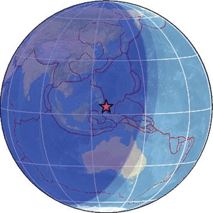
| Region | NORTH OF HALMAHERA, INDONESIA |
| Date time | 2026-02-14 19:29:25.9 UTC |
| Location | 4.315 ; 128.108 |
| Depth | 90 km |
| Distance | 361 km SE of Mati, Philippines / pop: 105,000 / local time: 03:29:25.9 2026-02-15 288 km N of Tobelo, Indonesia / pop: 10,000 / local time: 04:29:25.9 2026-02-15 |
Source parameters reviewed by a seismologist
All data providers for this event:
Badan Meteorologi, Klimatologi dan Geofisika -- Jakarta, Indonesia (BMKG)GeoForschungsZentrum (GFZ) -- Potsdam, Germany (GFZ)
Geophysical Survey of the Russian Academy of Sciences -- Obninsk, Russia (GSRAS)
Malaysian Meteorological Department -- Kuala Lumpur, Malaysia (MET)
National Earthquake Information Center, U.S. Geological Survey -- Golden, United States (NEIC)
Philippine Inst. of Volcanology and Seismology, Quezon City, Philippines -- Manila, Philippines (PIVS)
EMSC -- Arpajon, France (SC4)
Further information can be found at:
GeoForschungsZentrum (GFZ) -- Potsdam, Germany (GFZ)Badan Meteorologi, Klimatologi dan Geofisika -- Jakarta, Indonesia (BMKG)
National Earthquake Information Center, U.S. Geological Survey -- Golden, United States (NEIC)
Philippine Inst. of Volcanology and Seismology, Quezon City, Philippines -- Manila, Philippines (PIVS)