| Magnitude | 5.7 |
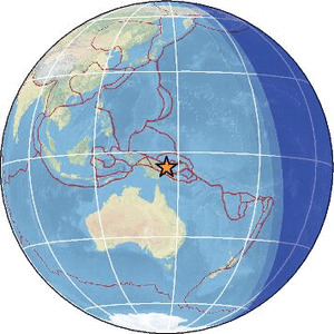
| Region | EASTERN NEW GUINEA REG., P.N.G. |
| Date time | 2026-02-21 06:18:44.0 UTC |
| Location | -5.307 ; 145.811 |
| Depth | 71 km |
| Distance | 487 km NNW of Port Moresby, Papua New Guinea / pop: 283,000 / local time: 16:18:44.0 2026-02-21 10 km SSE of Madang, Papua New Guinea / pop: 27,400 / local time: 16:18:44.0 2026-02-21 |
Source parameters reviewed by a seismologist
All data providers for this event:
Geoscience Australia, Canberra, ACT, Australia -- Canberra, Australia (AUST)British Geological Survey -- Edinburgh, United Kingdom (BGS)
French Polynesian Tsunami Warning Center - CEA -- Papeete, Polynesie Francaise - Tahiti (CPPT)
Badan Meteorologi, Klimatologi dan Geofisika -- Jakarta, Indonesia (BMKG)
Lamont-Doherty Earth Observatory (LDEO) -- New-York, United States (GCMT)
GeoForschungsZentrum (GFZ) -- Potsdam, Germany (GFZ)
Geonet, GNS science -- Lower Hutt, New Zealand (GNS)
Geophysical Survey of the Russian Academy of Sciences -- Obninsk, Russia (GSRAS)
Instituto Nazionale di Geofisica e Vulcanologia -- Rome, Italy (INGV) -- DOI: https://terremoti.ingv.it/en/iside
IPGP - Geoscope -- Paris, France (IPGP)
Kandilli Observatory and Earthquake Research Institute -- Istanbul, Türkiye (KOERI)
Instituto Geografico Nacional -- Madrid, Spain (IGN)
Ukrainian NDC, Main Center of Special Monitoring -- Kyiv, Ukraine (MCSM)
Malaysian Meteorological Department -- Kuala Lumpur, Malaysia (MET)
National Earthquake Information Center, U.S. Geological Survey -- Golden, United States (NEIC)
EMSC -- Arpajon, France (SC4)
Further information can be found at:
GeoForschungsZentrum (GFZ) -- Potsdam, Germany (GFZ)Badan Meteorologi, Klimatologi dan Geofisika -- Jakarta, Indonesia (BMKG)
National Earthquake Information Center, U.S. Geological Survey -- Golden, United States (NEIC)