| Magnitude | 4.6 |
| Region | IRAN-IRAQ BORDER REGION |
| Date time | 2026-02-27 03:51:38.4 UTC |
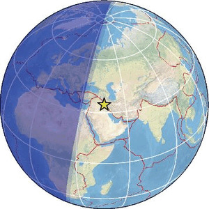
| Location | 34.446 ; 45.687 |
| Depth | 8 km |
| Distance | 113 km NW of Īlām, Iran / pop: 140,000 / local time: 07:21:38.4 2026-02-27 16 km WSW of Sarpol-e Z̄ahāb, Iran / pop: 51,600 / local time: 07:21:38.4 2026-02-27 |
Source parameters reviewed by a seismologist
All data providers for this event:
GeoForschungsZentrum (GFZ) -- Potsdam, Germany (GFZ)Geophysical Survey of the Russian Academy of Sciences -- Obninsk, Russia (GSRAS)
Ukrainian NDC, Main Center of Special Monitoring -- Kyiv, Ukraine (MCSM)
National Earthquake Information Center, U.S. Geological Survey -- Golden, United States (NEIC)
The research institute NORSAR -- Kjeller, Norway (NORSAR)
EMSC -- Arpajon, France (SC4)
Republic Hydrometeorological Institute -- Banja Luka, Bosnia-Herzogovina (SORS)
Further information can be found at:
Institute of Geophysics, University of Tehran -- Tehran, Iran (IGUT)International Institute for Earthquake Engineering and Seismology -- Tehran, Iran (IIEES)