| Magnitude | 5.2 |
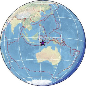
| Region | KEPULAUAN ALOR, INDONESIA |
| Date time | 2026-04-20 05:19:35.9 UTC |
| Location | -8.003 ; 124.330 |
| Depth | 180 km |
| Distance | 150 km WNW of Dili, Timor Leste / pop: 150,000 / local time: 14:19:35.9 2026-04-20 118 km WNW of Maubara, Timor Leste / pop: 16,300 / local time: 14:19:35.9 2026-04-20 |
Source parameters reviewed by a seismologist
All data providers for this event:
Geoscience Australia, Canberra, ACT, Australia -- Canberra, Australia (AUST)GeoForschungsZentrum (GFZ) -- Potsdam, Germany (GFZ)
Geonet, GNS science -- Lower Hutt, New Zealand (GNS)
Ukrainian NDC, Main Center of Special Monitoring -- Kyiv, Ukraine (MCSM)
Malaysian Meteorological Department -- Kuala Lumpur, Malaysia (MET)
National Earthquake Information Center, U.S. Geological Survey -- Golden, United States (NEIC)
EMSC -- Arpajon, France (SC4)
Further information can be found at:
GeoForschungsZentrum (GFZ) -- Potsdam, Germany (GFZ)Badan Meteorologi, Klimatologi dan Geofisika -- Jakarta, Indonesia (BMKG)
National Earthquake Information Center, U.S. Geological Survey -- Golden, United States (NEIC)