| Magnitude | 5.1 |
| Region | PERU-ECUADOR BORDER REGION |
| Date time | 2026-05-05 15:58:27.0 UTC |
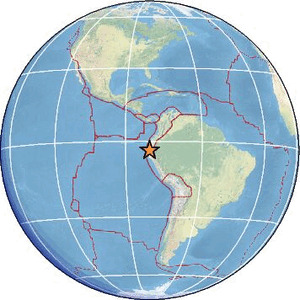
| Location | -3.534 ; -80.662 |
| Depth | 49 km |
| Distance | 84 km WSW of Machala, Ecuador / pop: 198,000 / local time: 10:58:27.0 2026-05-05 24 km W of Tumbes, Peru / pop: 109,000 / local time: 10:58:27.0 2026-05-05 |
Source parameters reviewed by a seismologist
All data providers for this event:
Geoscience Australia, Canberra, ACT, Australia -- Canberra, Australia (AUST)GeoForschungsZentrum (GFZ) -- Potsdam, Germany (GFZ)
Geophysical Survey of the Russian Academy of Sciences -- Obninsk, Russia (GSRAS)
Instituto Geofisico del Peru -- Lima, Peru (LIM)
Ukrainian NDC, Main Center of Special Monitoring -- Kyiv, Ukraine (MCSM)
National Earthquake Information Center, U.S. Geological Survey -- Golden, United States (NEIC)
Escuela Politecnica Nacional, Quito, Ecuador -- Quito, Ecuador (QUI)
Centro de Sismologia da Universidade de Sao Paulo (member of the RSBR) -- Sao Paulo, Brazil (USP)
EMSC -- Arpajon, France (SC4)
Further information can be found at:
Instituto Geofisico del Peru -- Lima, Peru (LIM)GeoForschungsZentrum (GFZ) -- Potsdam, Germany (GFZ)
Escuela Politecnica Nacional, Quito, Ecuador -- Quito, Ecuador (QUI)
National Earthquake Information Center, U.S. Geological Survey -- Golden, United States (NEIC)