| Magnitude | 4.7 |
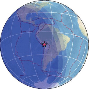
| Region | SOUTHERN PERU |
| Date time | 2026-06-21 08:50:13.9 UTC |
| Location | -17.055 ; -70.686 |
| Depth | 121 km |
| Distance | 116 km NW of Tacna, Peru / pop: 280,000 / local time: 03:50:13.9 2026-06-21 17 km ENE of Torata, Peru / pop: 7,000 / local time: 03:50:13.9 2026-06-21 |
Source parameters provided by:
National Earthquake Information Center, U.S. Geological Survey -- Golden, United States (NEIC)
All data providers for this event:
GeoForschungsZentrum (GFZ) -- Potsdam, Germany (GFZ)Instituto Portugues do Mar e da Atmosfera -- Lisbon, Portugal (IPMA)
National Earthquake Information Center, U.S. Geological Survey -- Golden, United States (NEIC)
EMSC -- Arpajon, France (SC4)
Further information can be found at:
Observatorio San Calixto -- La Paz, Bolivia (OSC)Instituto Geofisico del Peru -- Lima, Peru (LIM)
GeoForschungsZentrum (GFZ) -- Potsdam, Germany (GFZ)
National Earthquake Information Center, U.S. Geological Survey -- Golden, United States (NEIC)
Departamento de Geofisica, Universidad de Chile -- Santiago, Chile (CSN)