| Magnitude | 5.2 |
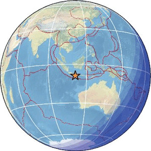
| Region | JAVA, INDONESIA |
| Date time | 2026-06-27 07:47:21.8 UTC |
| Location | -8.836 ; 111.171 |
| Depth | 47 km |
| Distance | 137 km SW of Blitar, Indonesia / pop: 132,000 / local time: 14:47:21.8 2026-06-27 112 km S of Ponorogo, Indonesia / pop: 79,000 / local time: 14:47:21.8 2026-06-27 |
Source parameters reviewed by a seismologist
All data providers for this event:
Geoscience Australia, Canberra, ACT, Australia -- Canberra, Australia (AUST)Seismological Survey of Serbia -- Belgrade, Serbia (BEO)
British Geological Survey -- Edinburgh, United Kingdom (BGS)
National Institute for Earth Physics -- Bucharest, Romania (NIEP)
French Polynesian Tsunami Warning Center - CEA -- Papeete, Polynesie Francaise - Tahiti (CPPT)
Badan Meteorologi, Klimatologi dan Geofisika -- Jakarta, Indonesia (BMKG)
GeoForschungsZentrum (GFZ) -- Potsdam, Germany (GFZ)
Geophysical Survey of the Russian Academy of Sciences -- Obninsk, Russia (GSRAS)
Kandilli Observatory and Earthquake Research Institute -- Istanbul, Türkiye (KOERI)
Ukrainian NDC, Main Center of Special Monitoring -- Kyiv, Ukraine (MCSM)
National Earthquake Information Center, U.S. Geological Survey -- Golden, United States (NEIC)
Republican Seismic Survey Center or Azerbaijan National Academy of Sciences -- Baku, Azerbaijan (RSSC)
EMSC -- Arpajon, France (SC4)
Seismological and Volcanological Observatory Center -- Dhamar, Yemen (YSVOC)
Further information can be found at:
GeoForschungsZentrum (GFZ) -- Potsdam, Germany (GFZ)Badan Meteorologi, Klimatologi dan Geofisika -- Jakarta, Indonesia (BMKG)
National Earthquake Information Center, U.S. Geological Survey -- Golden, United States (NEIC)