| Magnitude | 6.2 |
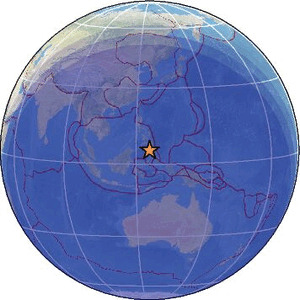
| Region | MINDANAO, PHILIPPINES |
| Date time | 2026-07-14 15:49:41.2 UTC |
| Location | 5.344 ; 125.184 |
| Depth | 57 km |
| Distance | 86 km SSE of General Santos, Philippines / pop: 679,000 / local time: 23:49:41.2 2026-07-14 32 km WSW of Sarangani, Philippines / pop: 7,500 / local time: 23:49:41.2 2026-07-14 |
Source parameters reviewed by a seismologist
All data providers for this event:
Geoscience Australia, Canberra, ACT, Australia -- Canberra, Australia (AUST)Seismological Survey of Serbia -- Belgrade, Serbia (BEO)
British Geological Survey -- Edinburgh, United Kingdom (BGS)
National Institute for Earth Physics -- Bucharest, Romania (NIEP)
HUN-REN EPSS Kövesligethy Radó Seismological Observato -- Budapest, Hungary (BUD)
China Earthquake Networks Center -- Beijing, China (CENC)
French Polynesian Tsunami Warning Center - CEA -- Papeete, Polynesie Francaise - Tahiti (CPPT)
Badan Meteorologi, Klimatologi dan Geofisika -- Jakarta, Indonesia (BMKG)
Lamont-Doherty Earth Observatory (LDEO) -- New-York, United States (GCMT)
GeoForschungsZentrum (GFZ) -- Potsdam, Germany (GFZ)
Geonet, GNS science -- Lower Hutt, New Zealand (GNS)
Geophysical Survey of the Russian Academy of Sciences -- Obninsk, Russia (GSRAS)
Instituto Portugues do Mar e da Atmosfera -- Lisbon, Portugal (IPMA)
Instituto Nazionale di Geofisica e Vulcanologia -- Rome, Italy (INGV) -- DOI: https://terremoti.ingv.it/en/iside
IPGP - Geoscope -- Paris, France (IPGP)
Kandilli Observatory and Earthquake Research Institute -- Istanbul, Türkiye (KOERI)
Instituto Geografico Nacional -- Madrid, Spain (IGN)
Ukrainian NDC, Main Center of Special Monitoring -- Kyiv, Ukraine (MCSM)
National Earthquake Information Center, U.S. Geological Survey -- Golden, United States (NEIC)
Philippine Inst. of Volcanology and Seismology, Quezon City, Philippines -- Manila, Philippines (PIVS)
Centro de Sismologia da Universidade de Sao Paulo (member of the RSBR) -- Sao Paulo, Brazil (USP)
EMSC -- Arpajon, France (SC4)
Seismological and Volcanological Observatory Center -- Dhamar, Yemen (YSVOC)
Further information can be found at:
Badan Meteorologi, Klimatologi dan Geofisika -- Jakarta, Indonesia (BMKG)National Earthquake Information Center, U.S. Geological Survey -- Golden, United States (NEIC)
GeoForschungsZentrum (GFZ) -- Potsdam, Germany (GFZ)
Philippine Inst. of Volcanology and Seismology, Quezon City, Philippines -- Manila, Philippines (PIVS)