| Magnitude | 5.0 |
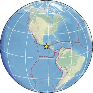
| Region | OFFSHORE CHIAPAS, MEXICO |
| Date time | 2026-07-31 16:15:57.2 UTC |
| Location | 14.407 ; -93.329 |
| Depth | 10 km |
| Distance | 128 km SW of Tapachula, Mexico / pop: 202,000 / local time: 10:15:57.2 2026-07-31 104 km WSW of Puerto Madero, Mexico / pop: 9,500 / local time: 10:15:57.2 2026-07-31 |
Source parameters reviewed by a seismologist
All data providers for this event:
British Geological Survey -- Edinburgh, United Kingdom (BGS)GeoForschungsZentrum (GFZ) -- Potsdam, Germany (GFZ)
Geophysical Survey of the Russian Academy of Sciences -- Obninsk, Russia (GSRAS)
Instituto Nicaraguense de Estudios Territoriales -- Managua, Nicaragua (INET)
Ukrainian NDC, Main Center of Special Monitoring -- Kyiv, Ukraine (MCSM)
National Earthquake Information Center, U.S. Geological Survey -- Golden, United States (NEIC)
Centro de Sismologia da Universidade de Sao Paulo (member of the RSBR) -- Sao Paulo, Brazil (USP)
EMSC -- Arpajon, France (SC4)
Servicio Sismologico Nacional, Instituto de Geofisica, UNAM -- Mexico City, Mexico (UNM)
Further information can be found at:
GeoForschungsZentrum (GFZ) -- Potsdam, Germany (GFZ)Servicio Sismologico Nacional, Instituto de Geofisica, UNAM -- Mexico City, Mexico (UNM)
National Earthquake Information Center, U.S. Geological Survey -- Golden, United States (NEIC)