| Magnitude | 4.8 |
| Region | MYANMAR-INDIA BORDER REGION |
| Date time | 2026-10-12 01:28:20.7 UTC |
| Location | 24.636 ; 94.478 |
| Depth | 84 km |
| Distance | 57 km E of Imphāl, India / pop: 223,000 / local time: 06:58:20.7 2026-10-12 49 km E of Thoubāl, India / pop: 44,400 / local time: 06:58:20.7 2026-10-12 |
Source parameters reviewed by a seismologist
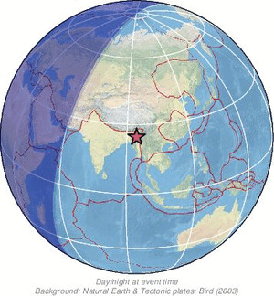
All data providers for this event:
HUN-REN EPSS Kövesligethy Radó Seismological Observato -- Budapest, Hungary (BUD)GeoForschungsZentrum (GFZ) -- Potsdam, Germany (GFZ)
Geophysical Survey of the Russian Academy of Sciences -- Obninsk, Russia (GSRAS)
Ukrainian NDC, Main Center of Special Monitoring -- Kyiv, Ukraine (MCSM)
India Meteorological Department, New Delhi, India -- New Delhi, India (NDI)
National Earthquake Information Center, U.S. Geological Survey -- Golden, United States (NEIC)
Republican Seismic Survey Center or Azerbaijan National Academy of Sciences -- Baku, Azerbaijan (RSSC)
EMSC -- Arpajon, France (SC4)
Further information can be found at:
National Earthquake Information Center, U.S. Geological Survey -- Golden, United States (NEIC)GeoForschungsZentrum (GFZ) -- Potsdam, Germany (GFZ)
India Meteorological Department, New Delhi, India -- New Delhi, India (NDI)