| Magnitude | 4.6 |
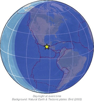
| Region | OFF COAST OF CHIAPAS, MEXICO |
| Date time | 2026-10-22 03:35:16.6 UTC |
| Location | 14.897 ; -93.941 |
| Depth | 32 km |
| Distance | 181 km W of Tapachula, Mexico / pop: 202,000 / local time: 21:35:16.6 2026-10-21 108 km S of Manuel Ávila Camacho (Ponte Duro), Mexico / pop: 1,700 / local time: 21:35:16.6 2026-10-21 |
Source parameters reviewed by a seismologist
All data providers for this event:
Instituto Nicaraguense de Estudios Territoriales -- Managua, Nicaragua (INET)National Earthquake Information Center, U.S. Geological Survey -- Golden, United States (NEIC)
EMSC -- Arpajon, France (SC4)
Servicio Sismologico Nacional, Instituto de Geofisica, UNAM -- Mexico City, Mexico (UNM)
Further information can be found at:
GeoForschungsZentrum (GFZ) -- Potsdam, Germany (GFZ)Servicio Sismologico Nacional, Instituto de Geofisica, UNAM -- Mexico City, Mexico (UNM)
National Earthquake Information Center, U.S. Geological Survey -- Golden, United States (NEIC)